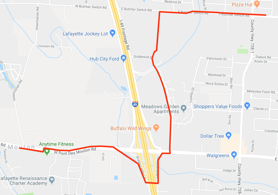
LUS has sent this map showing where they would like these poles. This is primarily through residential property which is a concern to many residents living alongside the path.
Below is an interactive map where you can see your property in relation to the proposed route.
The red line below is the proposed path for the transmission lines LUS is trying to install through several residential neighborhoods.
The blue lines are located 1,000 feet from the transmission lines. There is research that shows that property values can be effected by between 4-25% if a residence is located with 1,000 feet of a transmission line.
If you open this map in your Google Maps, it will add this route to your view. To remove it, click the layers button (looks like a cube shape button) and you should see a button that says “Path for Proposed Transmission Lines”. Click that button and it should disappear from your map.
